A dramatic weather shift could transform Sunday’s rain into dangerous snowfall
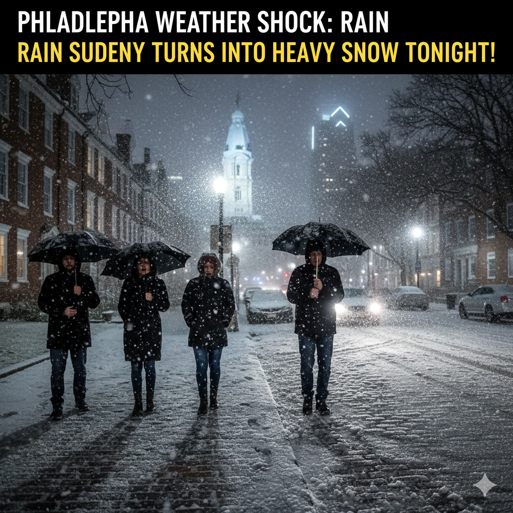
What begins as a wet and gloomy day across the Philadelphia region is expected to end in a winter shock. Meteorologists warn that a fast-moving winter storm will rapidly change rain into heavy snow, creating hazardous travel conditions and potentially covering parts of the area in significant snowfall within hours.
Residents are being urged to prepare early, as the sudden transition from rain to snow could make roads slippery and visibility poor during the storm’s strongest period.
From Rain to Snow: How the Storm Will Unfold
Forecasters say the system will arrive with steady rain during the morning and early afternoon. However, as colder air pushes into the region, temperatures will drop quickly, allowing precipitation to switch from rain to snow later in the day.
This rapid change is expected to occur during the evening hours, which could create dangerous conditions just as many people are traveling home or heading out for evening plans.
Weather experts note that storms involving both rain and snow are particularly challenging because wet surfaces can freeze quickly once temperatures fall.
Heavy Snowfall Expected in Parts of the Region
While snowfall totals may vary depending on location, some areas north and west of Philadelphia could see substantial accumulation. Forecast models suggest that certain communities may receive close to a foot of snow if heavier snow bands develop.
Urban areas may initially struggle to accumulate snow due to warmer ground temperatures, but heavier bursts of snowfall could still lead to rapid accumulation overnight.
Meteorologists caution that snowfall rates could increase quickly once the storm fully transitions into snow.
Travel Conditions Likely to Deteriorate Quickly
The biggest concern with this storm is timing. As rain changes to snow, road conditions may worsen rapidly, increasing the risk of accidents and travel delays.
Drivers are advised to limit unnecessary travel during peak snowfall periods. Wet roads turning icy could create hazardous driving conditions, especially on bridges and elevated highways where temperatures drop faster.
Public transportation and flights may also experience delays depending on snowfall intensity and visibility.
Why This Storm Could Be Impactful
Unlike slow-moving winter systems, this storm is expected to intensify quickly as cold air collides with moisture already in place. That combination can produce bursts of heavy snow in a short amount of time.
Weather specialists explain that even a few hours of intense snowfall can significantly disrupt daily life, particularly in densely populated areas like the Philadelphia metro region.
The storm’s fast pace means conditions could change dramatically within a short window, leaving little time for adjustment once snowfall begins.
What Residents Should Do Now
Officials recommend preparing before temperatures fall and snow begins accumulating. Simple steps can help reduce risks during the storm:
- Avoid nonessential travel during heavy snowfall
- Charge electronic devices in case of power interruptions
- Keep emergency supplies in vehicles
- Allow extra commute time Monday morning
- Monitor updated weather alerts throughout the evening
Preparing early is especially important because the storm’s timing may catch many people off guard.
When Conditions Will Improve
Snowfall is expected to taper off overnight or early the following day as the storm system moves away from the region. Cold temperatures may linger, however, meaning icy patches could remain on untreated roads into the morning hours.
Gradual clearing is forecast afterward, but colder-than-average temperatures may continue for a short period following the storm.
Conclusion: A Fast-Changing Storm Demands Quick Preparation
Philadelphia’s upcoming winter storm highlights how quickly weather conditions can shift during late winter. What starts as simple rain could end with snow-covered roads and disrupted travel across the region.
Residents should stay alert, monitor forecasts, and plan ahead to avoid unnecessary risks. With preparation and caution, communities can safely navigate this sudden return to winter weather.
For More Read
Florida Hit by Surprise Cold Blast — Freeze Alerts Leave Residents Shivering
Airport Chaos Begins: TSA PreCheck and Global Entry Suddenly Shut Down Nationwide
Courtroom Shock: Judge Warns Zuckerberg’s Team Over Recording Glasses During Explosive Trial
2026 Winter Games Alpine Skiing: The Medal Races Everyone Will Be Talking About